Notable Features
The following are features of interest in the GeoSpatial Software Development Kit. The list is NOT exhaustive.
- Read and Write Shapefiles
- Query features from shapefiles with spatial and/or attribute queries (i.e., SQL syntax)
- Create new shapefiles
- Add and Delete features
- Modify attributes of features
- Supports the prj file for spatial reference information
- Uses spatial indexing for efficient retrieval of features
- All vector and raster formats supported by GDAL are supported
- Vector and Raster Layer classes: encapsulates the vector and raster databases for display of data in a map class
- Renderer classes: single symbol, unique value, value range, color stretch, and RGB renderers for the display of vector and raster data
- Symbols: basic marker, line and polygon symbology classes are included in the SDK. There is a picture based marker symbol class that allows for the use of images as symbols for developing specialized maps such as electric, water, or sewer maps.
- Labeling: basic data bound labeling of features, with options to control the font, and text color
- OpenGL Display: the SDK currently contains a display class implemented on OpenGL with hardware accelerated drawing if available.
- GPS driver class for integration with a gps device
- Coarse grained classes: classes exist in the SDK to maximum code reuse from application to application (handles all display, and basic tool implementations). The SDK is designed so that applications can be developed quickly without the compromise of a robust and fast geospatial application.
|
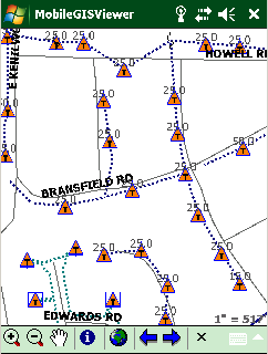
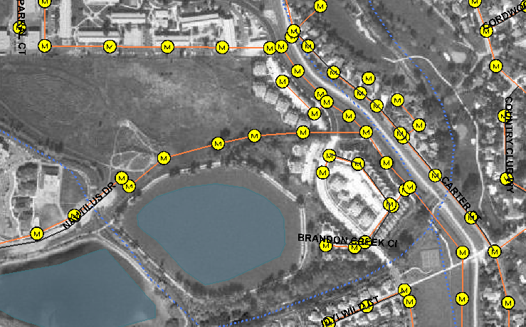
Utility Map on Mobile Device
|
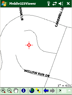
GPS integration into mobile application
|
|